

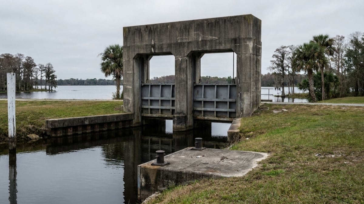
A home on East Lake Tohopekaliga in St. Cloud has no boat route to Lake Toho or to the rest of the Kissimmee Chain of Lakes. The St. Cloud Canal carries water from East Lake Toho into Lake Toho through the S-59 water control structure, and that structure has no navigation lock. The South Florida Water Management District says in its own boater guide that “boaters cannot travel through the canals connecting” East Lake Toho with Lakes Tohopekaliga, Cypress, Hatchineha and Kissimmee.
If running your own boat down the chain is part of the reason you are shopping this corridor, that single fact decides which side of the canal you buy on.
The structure between the two lakes carries water, not traffic
S-59 sits at the outlet of East Lake Toho. It regulates water levels on East Lake Toho, Fells Cove and Ajay Lake, and discharges into the St. Cloud Canal, designated C-31. That canal enters Lake Toho at Goblet’s Cove, on the lake’s northeastern side.
The District’s current navigation page lists five locks on the Kissimmee Waterway: S-65E, S-65D, S-65A, S-65 and S-61. The northernmost of the five, S-61, sits at the outlet of Lake Toho. Nothing on that list sits between East Lake Toho and Lake Toho, and the District’s boater guide sends anglers headed for East Lake Toho to parks and fish camps instead.
The water a St. Cloud dock actually reaches
Behind S-59, three water bodies share one managed pool, so a boat launched on any of them can reach the other two. Measured surface areas compiled in the interagency Kissimmee Chain of Lakes Long-Term Management Plan put East Lake Toho at 11,048 acres, Fells Cove at 837 and Ajay Lake at 137. That totals about 12,022 acres of open water. Lake Conlin and Lake Runnymede sit in the same management area as secondary lakes.
Two inflows feed the pool, and neither one opens a route out of it. Boggy Creek enters at the northwestern corner and contributes roughly 69 percent of the water coming into the management area, and the Ajay-East Tohopekaliga Canal, C-29A, brings water down from the Lake Hart and Lake Mary Jane area.
What sits on the far side of the gates
Lake Toho alone measures 18,819 acres in the same plan. From Lake Toho, the S-61 Southport Lock lowers boats through the Southport Canal, C-35, into Cypress Lake, Lake Hatchineha and Lake Kissimmee, which add 42,581 acres among them. Keep going through S-65, S-65A, S-65D and S-65E and the route continues down the Kissimmee River toward Lake Okeechobee.
Adding Lake Toho to the three lakes below it gives about 61,400 acres reachable by water from the Kissimmee side, against 12,022 acres from the St. Cloud side, a difference of roughly five times the water that turns on one structure.
Locking through is free during normal operating hours and takes about 15 minutes at most structures. District locks on the Kissimmee River and the Kissimmee Chain run 7 a.m. to 6 p.m. on weekdays year round. Weekend hours run 5:30 a.m. to 7:30 p.m. from March 1 through October 31, and 5:30 a.m. to 6:30 p.m. from November 1 through February 28.
| Question | East Lake Toho (St. Cloud side) | Lake Toho (Kissimmee side) |
|---|---|---|
| Structure at the outlet | S-59, into the St. Cloud Canal (C-31) | S-61, into the Southport Canal (C-35) |
| Navigation lock | None | Yes, the Southport Lock |
| Open water reachable by boat | About 12,022 acres: East Lake Toho, Fells Cove, Ajay Lake | 18,819 acres, plus 42,581 acres through the lock |
| Onward route | None by water | Cypress, Hatchineha, Kissimmee, then the Kissimmee River |
| City of St. Cloud ramps on it | Lakefront Park and Chisholm Park | Partin Triangle Park |
Where a St. Cloud owner launches for each lake
The City of St. Cloud runs three public boat ramps, and they do not all serve the same water. Lakefront Park at 1402 Lakeshore Blvd. is on East Lake Toho, open 24 hours, with three separate access ramps and a walking dock. Chisholm Park at 4700 Chisholm Park Trail is also on East Lake Toho, open dawn to dusk. Partin Triangle Park at 2830 Neptune Road is on Lake Tohopekaliga, open dawn to dusk, and its address is in Kissimmee rather than St. Cloud. A St. Cloud owner headed for the chain trailers the boat to that third ramp.
Vehicles with trailers pay $6 for the day through the Passport Parking app, or carry an annual permit. The permit costs $35 a year for people living inside St. Cloud city limits and $150 a year for Osceola County residents outside the city, and the city does not sell it to anyone living outside the county. It runs by calendar year, is limited to one per household, and requires proof of vehicle and trailer ownership plus proof of residence at the St. Cloud Civic Center. Failing to pay for trailer parking carries a $35 fine, and trailers may not park along Lakeshore Blvd. or Chisholm Park Trail.
One gap is worth closing before you rely on it. The city’s page lists three ramps, then describes the annual permit as covering “both city boat ramps” and names only Lakefront and Chisholm in its daily-parking instructions and its posted rules. Whether that permit covers trailer parking at Partin Triangle is not stated anywhere on the page. Call Parks and Recreation at 407-957-7243 and get the answer in writing if the Lake Toho ramp is the one you plan to use. The same page posts scheduled ramp closures for parades and maintenance, which is worth checking before a trip.
What else to confirm on a St. Cloud waterfront listing
- Identify the water body behind the view. East Lake Toho, Fells Cove, Ajay Lake, Lake Runnymede, a connected canal and a stormwater pond all photograph alike in a listing. Confirm the frontage on the survey and the parcel record.
- Treat water depth as a variable. The Florida Fish and Wildlife Conservation Commission has run a drawdown and habitat enhancement project on East Lake Toho since 2019, scraping woody growth and muck from the lake bottom in spring 2020 and planting 76,000 native plants along the northeast shore in 2021. A dock that floats comfortably one year is not guaranteed the same depth in another.
- Pull the FEMA flood map panel for the parcel and confirm the flood zone the insurance quote was written against before the inspection period ends.
- Keep navigation and dock approval separate. Being able to reach water is a different question from being allowed to build or rebuild a dock on it. We walked through the permitting version of that question for Orange County in our guide to Butler Chain dock permits, and the agencies and thresholds there do not carry over to Osceola County.
- Read the community documents on boat and trailer storage. Where a trailer may sit at the house is governed by the recorded documents and the local code, and in a newer community by the district as well. Our explainer on how HOA and CDD control works in Osceola County covers who actually sets those rules and when that changes.
Frequently asked questions
Can I take my boat from East Lake Toho to Lake Toho?
No. The two lakes connect hydrologically through the S-59 structure and the St. Cloud Canal, and no navigation lock sits on that route. The South Florida Water Management District’s Kissimmee Waterway boater guide says boaters cannot travel those connecting canals and points them to parks and fish camps for access. To fish both lakes in one weekend you trailer between them.
Is there any lock I can use on the Kissimmee Chain?
Yes, starting from Lake Toho and heading south. The S-61 Southport Lock is the northernmost of the five District locks on the Kissimmee Waterway, followed by S-65, S-65A, S-65D and S-65E down the Kissimmee River. Locking through is free during normal operating hours and takes about 15 minutes at most structures.
Does a St. Cloud address mean the home is on East Lake Toho?
Not by itself. St. Cloud addresses reach well north and east of the lake, into areas near Lake Runnymede, the Alligator Chain and Lake Gentry, and the city’s own Lake Toho ramp carries a Kissimmee address. Match the parcel to a specific water body before you price waterfront into an offer, because the pool a home sits on determines where the boat can go.
Where to go from here
Live Move Orlando publishes the full corridor overview for this part of the south metro in its Kissimmee relocation guide. This article takes the narrower question that guide does not answer, which is what the water behind a specific address connects to. For current asking prices and closed sales on this side of the county, our St. Cloud housing market report tracks the numbers.
Waterfront here is priced on access as much as on frontage, and the two are not the same thing. If you are weighing a St. Cloud lake home against one on the Kissimmee side, book a strategy session at mvphomegroup.com/nelsoncruz and we will check the parcel against the pool it sits on before you write the offer.
Nelson Cruz, P.A.
Founder & CEO
MVP Home Group, Real Broker LLC
Nelson brings nearly two decades in law enforcement to his work in real estate. View Nelson’s profile or contact our team at 407-901-9939 or [email protected].
Featured image: AI-generated editorial illustration of a concrete water control structure with two closed steel gates spanning a narrow canal, with a broad lake and a treeline of cypress and cabbage palms beyond it. It does not depict a particular property or a particular structure. Sources: South Florida Water Management District Navigation page and Guide to the Kissimmee Waterway; the interagency Kissimmee Chain of Lakes Long-Term Management Plan (2011 interagency team draft revision) for structure relationships and measured lake areas; City of St. Cloud Parks and Recreation Boat Ramps page; Osceola County Find a Boat Ramp; Florida Fish and Wildlife Conservation Commission release on the East Lake Toho habitat project, dated September 30, 2021. Lock hours and fees are the published figures and can change.