

If the acreage you are looking at near Groveland sits inside the Green Swamp Area of Critical State Concern, what changes? Lake County allows one dwelling unit per 5, 10 or 20 net buildable acres across the three rural Green Swamp categories, and those are the only densities that apply. It will not approve more than 120, 60 and 35 lots a year for platting in those categories, or issue more than 100, 50 and 50 building permits. Every development order it does issue then goes to the state, which has 45 days to appeal before the approval takes effect.
Where the Green Swamp designation comes from
This is a state designation, not a county overlay a board can lift on a Tuesday night. The Florida Legislature designated it an Area of Critical State Concern effective July 1, 1979 under Fla. Stat. 380.0551. FloridaCommerce, the state land planning agency, puts it at roughly 322,690 acres, about 504 square miles, across northern Polk and southern Lake Counties, because the Floridan Aquifer peaks there and the wetlands form the headwaters of four rivers.
The boundary is a 1979 metes and bounds description in Rule 28-26.002, Florida Administrative Code. Near Clermont and Groveland it tracks the south right of way of State Road 50, the canal between Lake Minnehaha and Lake Minneola, Lake Louisa Road and then roughly 26 miles south along the west side of U.S. 27, with Lake Louisa State Park expressly excluded. Section 380.0551 also ordered a review of the land immediately south of Clermont for possible deletion, which is one reason parcels a few miles apart land on opposite sides. Treat it as a question for the county, never a conclusion from a map pin.
Four land use categories decide how many homes a parcel can hold
Policy I-4.2.1 of the 2030 Lake County Comprehensive Plan, updated March 4, 2025, states that the densities and intensities in these policies are the only ones that apply inside the area.
| Future land use category | Maximum density | Max impervious surface ratio | Minimum common open space |
|---|---|---|---|
| Green Swamp Ridge | 4 units per net buildable acre | 0.45 | 40% |
| Green Swamp Rural | 1 unit per 5 net buildable acres | 0.20 (0.30 agricultural, civic, recreational) | 60% |
| Green Swamp Rural/Conservation | 1 unit per 10 net buildable acres | 0.20 | 80% |
| Green Swamp Core/Conservation | 1 unit per 20 net buildable acres | 0.10 | 90% |
Ridge surprises people. At four units per net buildable acre it is ordinary suburban density, so a Green Swamp address tells you little until you know the category. Height is capped at 40 feet in all four.
Density runs against net buildable acres, with wetlands handled separately at a transfer rate of one unit per 20 acres of wetland shifted onto the uplands. On a hypothetical 40 acre Green Swamp Rural parcel split evenly, the 20 upland acres yield 4 units and the wetland transfer adds 1, for 5 units total, all sited on the upland half. In the three rural categories, any residential development of more than six lots must also be a clustered Rural Conservation Subdivision or a Planned Unit Development.
The annual lot and permit caps most buyers never hear about
This has no equivalent in most of Central Florida. The plan sets a hard annual ceiling on county approvals inside each rural category:
- Green Swamp Rural: no more than 120 lots a year approved for platting, and no more than 100 building permits.
- Green Swamp Rural/Conservation: no more than 60 lots a year for platting, and no more than 50 building permits.
- Green Swamp Core/Conservation: no more than 35 lots a year for platting, and no more than 50 building permits.
Added together that is 215 lots and 200 building permits across the three categories in a calendar year. If you are buying raw land with a build in mind, or a lot from a seller who is mid-plat, where that application sits in the queue is a real question for the county.
Water and septic rules that stay with the land after closing
Service expectations run opposite to most of the metro. In Green Swamp Rural, homes are served by private wells and on-site wastewater systems unless the property meets all three of these: directly adjacent to an Urban Future Land Use Series, within 660 feet of an existing public utility, and inside an ethylene dibromide zone identified by the Florida Department of Environmental Protection. Rural/Conservation and Core/Conservation state wells and on-site systems with no exception, while Ridge requires central sewer at or above one unit per net buildable acre. Our guide to buying with a private well covers the records to ask for.
Policy I-4.4.6 then adds requirements no standard inspection contingency will surface:
- Septic tanks and drainfields need a 100 foot setback from the furthest upland extent of any wetland or water body.
- Lots legally created on or before March 2, 1993, plus lots in the subdivisions named in the plan’s Table FLUE 7, may qualify for an administrative adjustment where the lot would otherwise be unbuildable. That table lists Groveland Farms, recorded September 26, 1911, alongside Postal Colony, Lake Louisa Park and roughly two dozen others.
- At least once every five years, every owner of a lot with a septic tank inside the area is to have it cleaned and inspected to Lake County Department of Health requirements, and to make the repairs needed for compliance.
- The developer is directed to disclose these conditions to the lot purchaser on the sales contract or deed.
- Policy I-4.4.8 requires a detailed flood insurance study for subdivision proposals with five or more acres or 50 or more lots in the 100 year floodplain, and Rule 28-28.008, Florida Administrative Code puts the first floor at least 12 inches above the regulatory flood level in a flood prone area.
That five year cycle is a recurring obligation traveling with the property, which is a different thing from the one-time pump-out or septic inspection ordered before closing. Ask the seller for the last record, and price the extra foot of elevation into both a build budget and an insurance quote.
An approval here is not final the day the county issues it
Under Fla. Stat. 380.05(19), the local government must notify the state land planning agency of any development permit application inside an area of critical state concern unless the agency waived that notice in writing. FloridaCommerce’s rendering instructions cover the back end: development orders, including permits, plats and re-plats, go to the agency within five days after the local appeal period expires, and the agency then has 45 days to appeal or the order becomes effective. Filing a notice of appeal stays the order until the appeal finishes, under Fla. Stat. 380.07(4). On a closing calendar, the approval date and the effective date are not the same date.
What to check before you write the offer
- Confirm the parcel is inside the boundary with the county rather than inferring it from the 1979 description.
- Get the future land use category in writing. Ridge at four units per acre and Core/Conservation at one per 20 acres are both Green Swamp.
- Ask who has jurisdiction. Lake County’s Office of Planning and Zoning in Tavares, 352-343-9641, covers unincorporated Lake County under the county plan. If the parcel sits inside Groveland or Mascotte city limits, ask that city for its own category and standards.
- Ask whether the lot is a buildable lot of record. Fla. Stat. 380.05(18) preserves rights vested before the regulations applied, and Rule 28-28.004 lets an owner seek a determination from the local government or the state agency under Fla. Stat. 120.565.
- Separate farming from building. Rule 28-28.003 exempts crops, trees, livestock and related uses such as wells and access roads, and treats fallow land as agricultural. File a development permit application on that land and the regulations apply.
- Pull the septic history and the last five year cleaning and inspection record, then check the drainfield against the 100 foot wetland setback.
Common questions
Does being in the Green Swamp mean I cannot build a house?
No. Residential use is a typical use in all four categories above, and Fla. Stat. 380.05(1)(b) bars the Administration Commission from adopting a rule that imposes a development moratorium in an area of critical state concern. What changes is density, open space, impervious surface, water and wastewater service, and the review timeline.
Can I split my acreage into lots for my children?
Only within the density your category allows, measured on net buildable acres. In Green Swamp Rural, 15 acres of buildable upland supports three units at one per five acres, and a division producing more than six lots has to be a clustered Rural Conservation Subdivision or a Planned Unit Development. The annual platting caps apply on top of that.
Is the Green Swamp the same thing as a FEMA flood zone?
No, though they frequently overlap. A FEMA Special Flood Hazard Area drives the federal mandatory purchase requirement on a federally backed loan. The Green Swamp is a state land use designation that can require a flood study, an elevated first floor and wetland setbacks on top of whatever the flood map says. A parcel can sit in one, both or neither.
Where to go from here
South Lake County is where buyers go to get land, and the rules governing that land live in a state rule and a county plan rather than a listing remark. For the corridor overall, Live Move Orlando publishes the full Groveland relocation guide. For what homes there are trading at, see our Groveland housing market report and our Groveland community page.
To have a specific parcel’s land use category, plat history and approval timeline confirmed before your inspection period runs, book a strategy session with our team.
Nelson Cruz, P.A.
Founder & CEO
MVP Home Group, Real Broker LLC
Nelson brings nearly two decades in law enforcement to his work in real estate. View Nelson’s profile or contact our team at 407-901-9939 or [email protected].
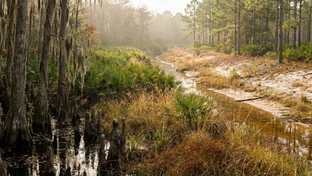
Featured image: AI-generated editorial illustration of a Central Florida wetland edge, with bald cypress trunks and cypress knees standing in dark water on the left, saw palmetto and wiregrass through the middle, a shallow tea-colored drainage swale, and dry pale sand and slash pine flatwoods beyond it in late afternoon haze. Not a particular property or parcel.